A Guide to Lucy Occultation Maps
Dec 20, 2021
By Brian Keeney
We provide detailed maps for a curated list of upcoming occultations by Lucy targets. This post is a guide to their interpretation, using the Polymele occultation on March 27, 2022 as an example.
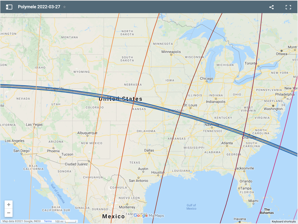
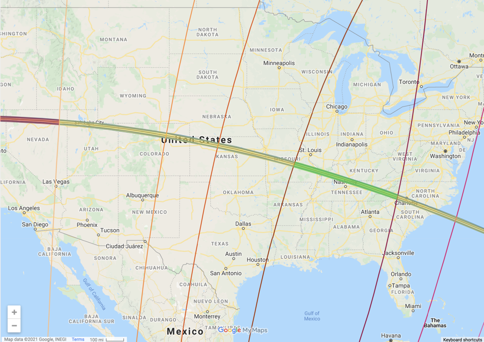
The default view for this event has several sets of colored lines and looks like this:
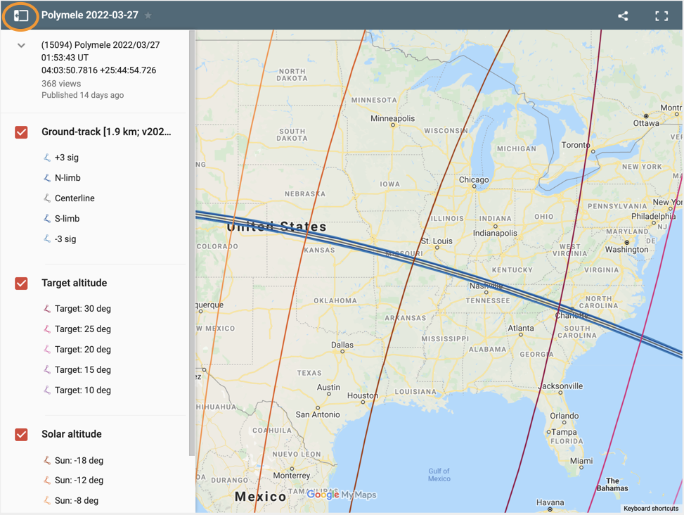
Clicking the icon in the upper left corner reveals the available map layers. The ground-track, target altitude, and solar altitude layers are turned on by default, but can be toggled off by clicking the check mark next to the layer name.
The predicted shadow path is shown by the ground-track layer. The gray line is the predicted centerline, and the expected size is shown in dark blue. We don’t have perfect knowledge of the asteroid’s orbit or the position of the star being occulted, so our predictions have uncertainty. The light blue lines show the 3-sigma uncertainty of the prediction. We have high confidence that the shadow will pass somewhere within the light blue lines.
The target altitude layer shows how far the target star is located above the horizon at event time. Stars are much harder to observe when they are near the horizon, so it is best to be located where they are high in the sky.
The solar altitude layer shows how far the Sun is located below the horizon at event time. The target star is only visible at night, when the Sun is below the horizon.

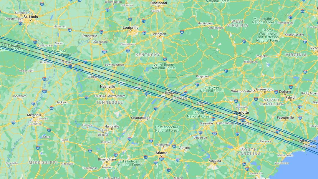
Combining all of this information tells us that the best places to observe this event are between eastern Missouri and western North Carolina.
Observing this occultation requires a telescope because the star is not bright enough to see with the naked eye. On the event page we list the time of the occultation (01:53:43 UT) for the middle of the shadow path as it crosses the Earth, but the time of the event changes depending on where the observer is located. For this event, observers in eastern Missouri will see the occultation at approximately 01:56:28 UT (March 26 at 8:56:28 PM local time) and those in western North Carolina will see it at approximately 01:56:42 UT (March 26 at 9:56:42 PM local time). Here UT is Universal Time or Greenwich Mean Time, and the local times above take into account that Missouri will be on Central Daylight Time on March 26 and North Carolina will be on Eastern Daylight Time.